Plateau Sector 04. Athena's own
plans, drawn on the approach and kept current through the founding years — the same sheets,
redrawn as the place stopped being a proposal.
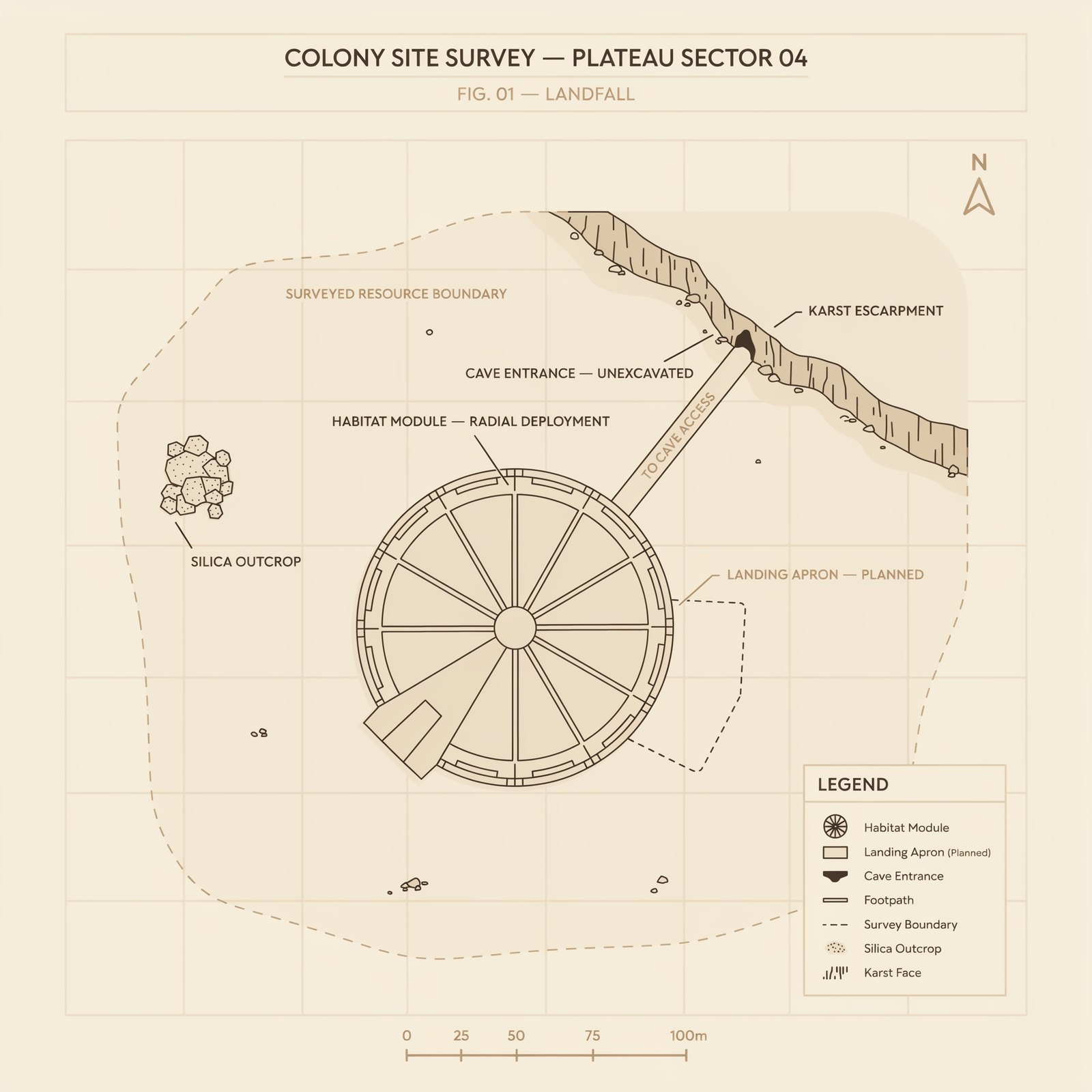
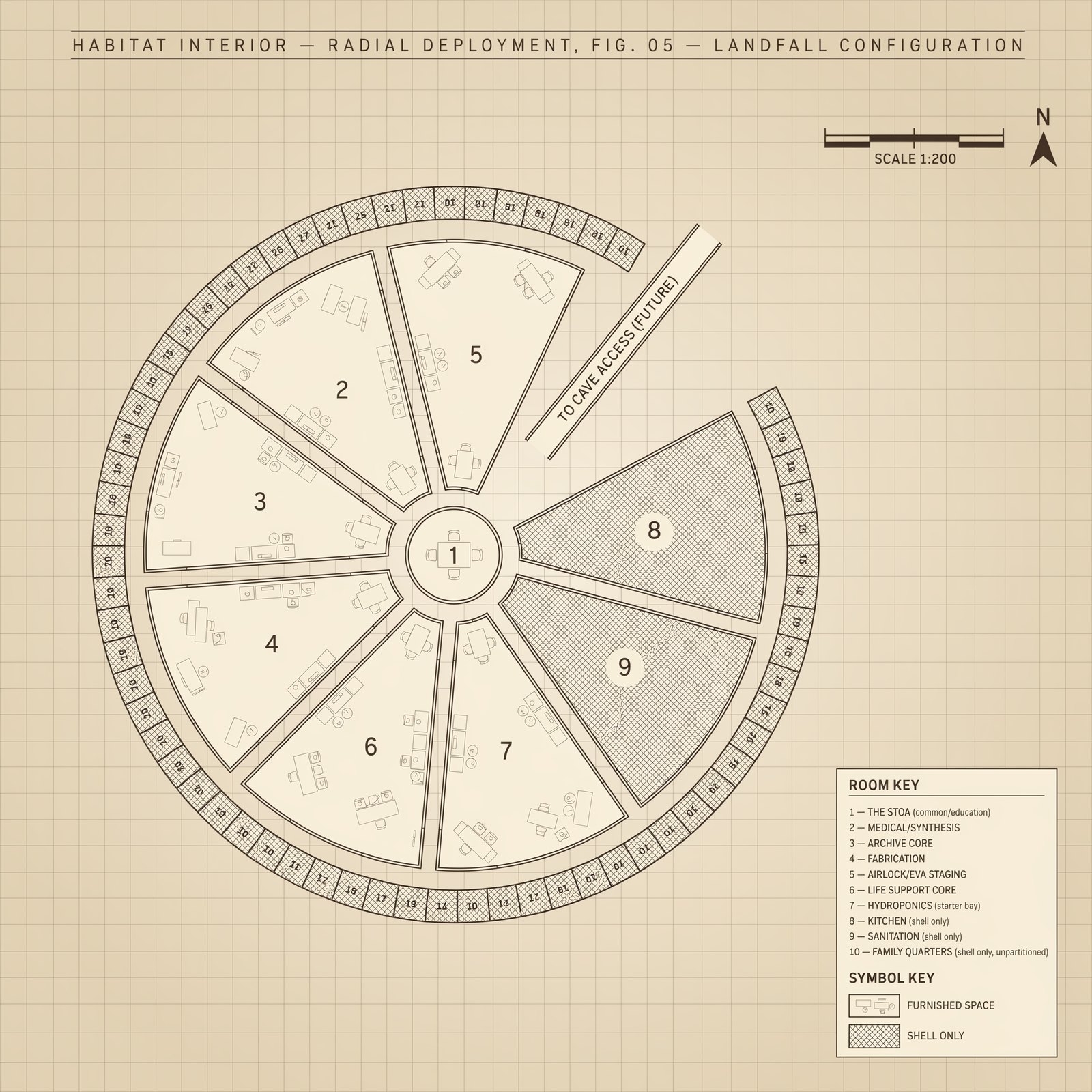
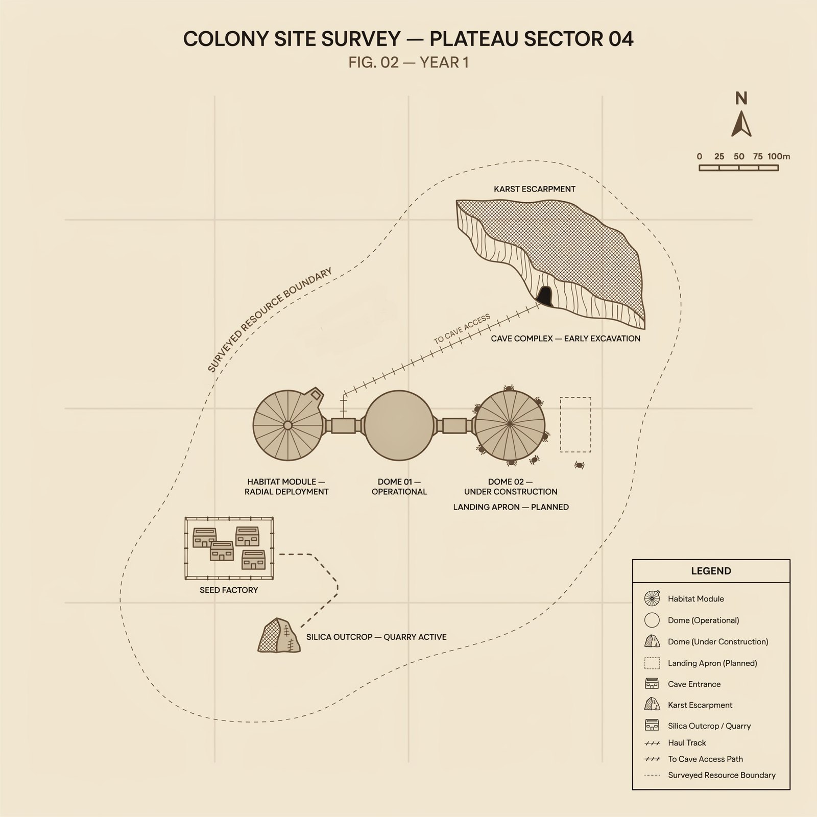
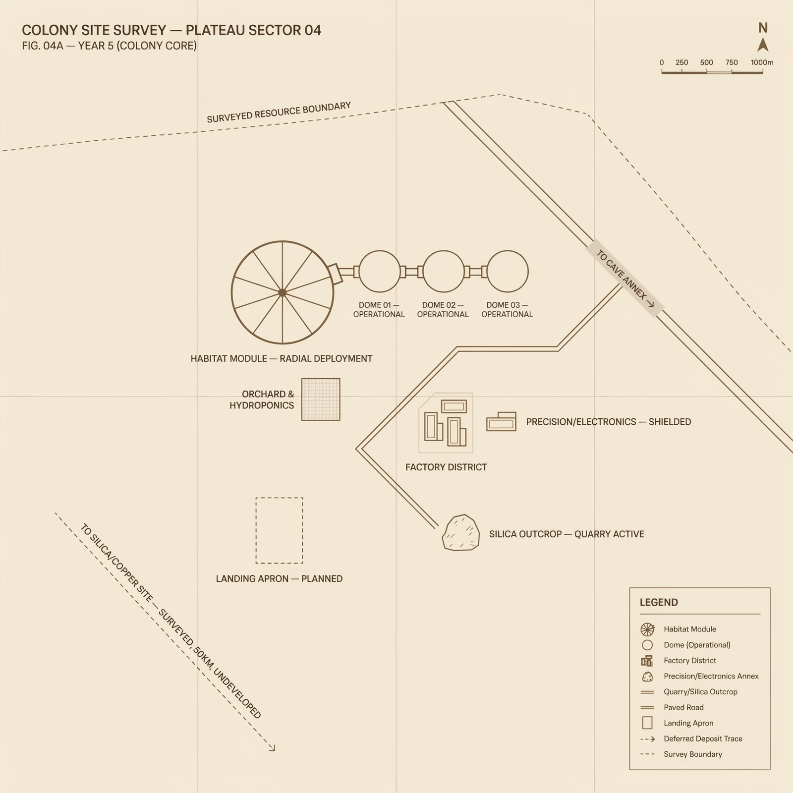
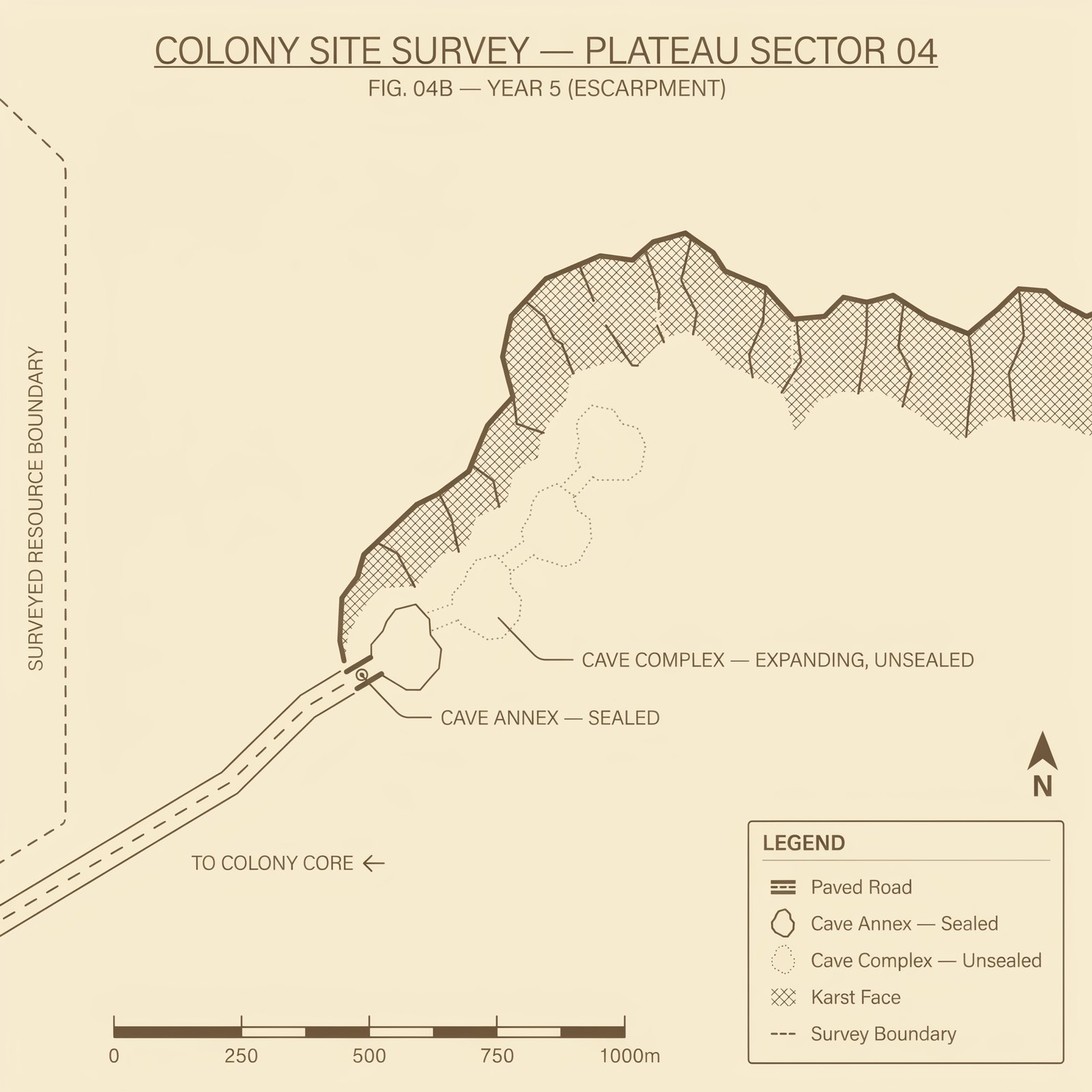
Fig. 01 — LandfallThe site as Athena chose it. One habitat module on the plateau; the karst escarpment to the north-east; the cave entrance surveyed but unexcavated; the landing apron still only a dashed line. The silica outcrop that will become the quarry is a scatter of stones.Fig. 05 — Habitat interior, landfall configurationNine wedges around a common core. The Stoa at the centre, then medical, archive, fabrication, airlock, life support, hydroponics. Kitchen, sanitation and family quarters were delivered as shell only — unpartitioned, waiting for people who did not yet exist to decide what they wanted.Fig. 02 — Year OneDome 01 operational and Dome 02 under construction. The seed factory running; the silica outcrop become an active quarry with a haul track to it. The cave complex opened, and a path worn to it before there was a road.Fig. 04a — Year Five, the colony coreThree domes operational. A factory district, a shielded precision annex, orchard and hydroponics, and a paved road running out to the cave. Note the scale: this plate is drawn at a kilometre, where Fig. 01 was drawn at a hundred metres.Fig. 04b — Year Five, the escarpmentThe cave annex sealed and in use; the complex beyond it expanding and unsealed. What was a footpath in Year One is a paved road, and what was a survey note is a working annex a kilometre from the core.